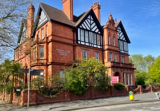
People and houses in Salford between c1890 and 1970.
Drawings and research by Laura Janicka
This post is based on our exhibition that was on show between the 25th January and 25th of April, 2024 at the Working Class Movement Library. Portrait photographs of Salford working-class people are set alongside photos and architectural drawings that illustrate the type of house they lived in. Each portrait is linked to a different type of dwelling; some were very common in Salford others were quite specific and have become obsolete.
When set side-by-side these images evoke memories and make us wonder about the daily lives and struggles of families in Salford. Some portraits are haunting, shocking even, making us think about the living conditions families endured, others are sweet and amusing, reminding us that no matter how communities change over time, some things – like cutting a wedding cake, or posing with the new bike on the front lawn – never change.
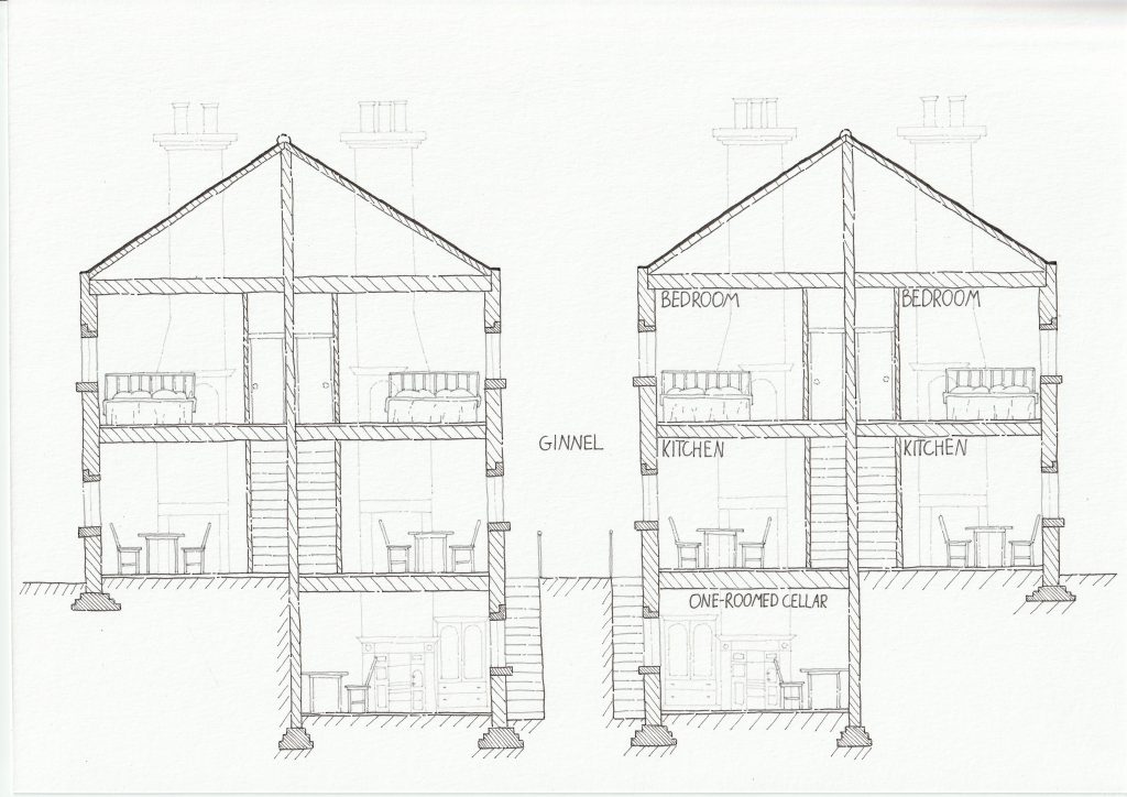
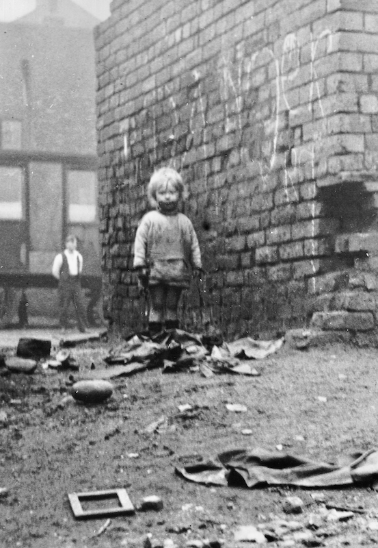
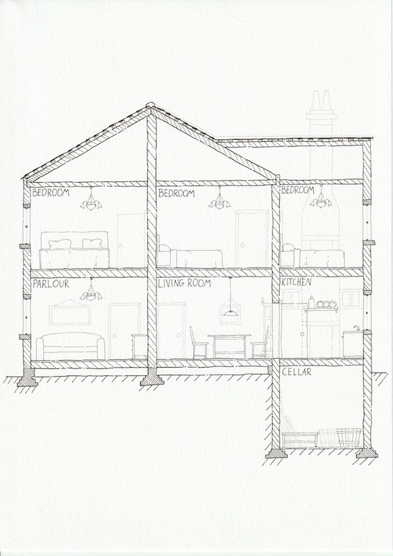
Mrs Ridgeway, the Cellar Dwelling, c1890
Mrs Ridgeway is sitting on a chair in front of her cellar dwelling in Clifton where she lived. The photo was sent by A Gaskell to Mr Cotton who lived on Manchester Road, Clifton in 1962. Unfortunately, we don’t know who they were and why the photo was sent, but A Gaskell’s letter reads: “[the photo] was taken from the rear of the old houses (now demolished) adjoining the ginnel opposite Billy Lane which, from the road frontage appeared as two-storied houses with cellar, but from the rear, owing to the difference in ground level, were three storied.”
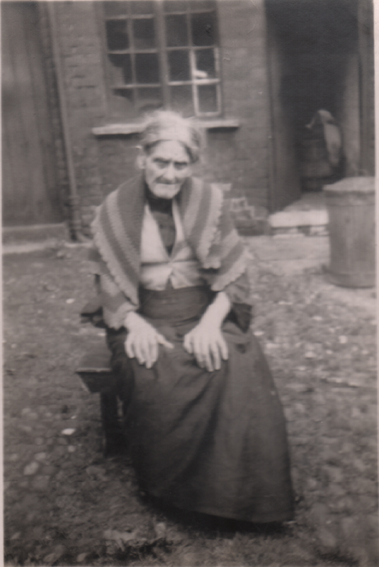
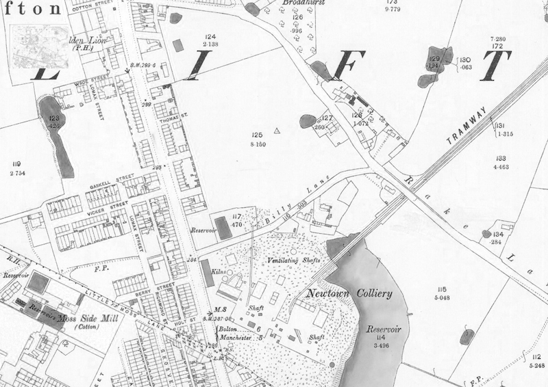
There were six cellar dwellings in total in the ginnel and each was occupied by a large family. The ginnel can be located on the map showing Clifton in 1893. It seems that Mrs Ridgeway lived between Vicker and Berry Streets and perpendicular to Manchester Road and Lomax Street.
Cellar dwellings were typically comprised of one room with walls that were one-brick thick and flagstone floors placed directly on bare earth. We were unable to find photographs or drawings of these cellar dwellings in Clifton so the hand drawing was inspired by a illustration in a book and shows a section of a comparable cellar dwelling.
Portrait photograph: Digital Salford, LB00133.
Map: National Library of Scotland, OS Map, Lancashire XCV.16 1889-1891.
Hand drawing: the drawing depicts a section of two-story back-to-back terrace houses with cellar dwellings underneath, inspired by illustrations of similar dwellings in publications. See: Timmins, G. (2013). Housing Industrial Workers during the 19th Century: back-to-back housing in textile Lancashire. Industrial Archaeology Review and Hatton, J. (1854). A Lecture on the Sanitary condition of Chorlton-upon-Medlock [Lecture Paper]. Manchester and Salford Sanitary Association. Chorlton-upon-Medlock.
Mrs Emma Orrett, the Salford Workhouse, c 1900
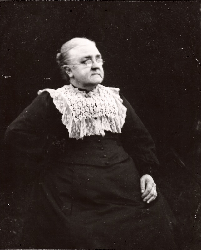
Mrs Orrett entered the Salford Workhouse as an inmate in 1878 with her two children (9 months and 7 years old). Her husband had died in 1872 and she was no longer able to support herself as a single mother.
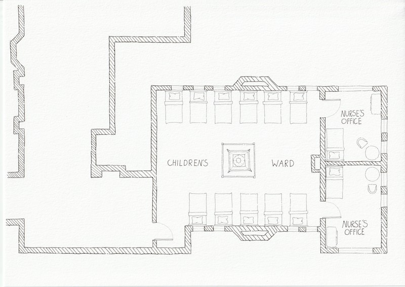
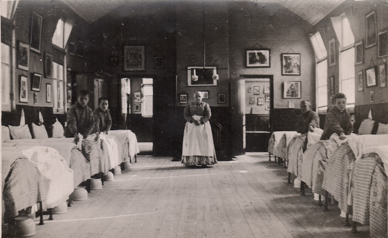
In 1882 she became the “Night Nurse” at the Children’s Hospital which was part of the workhouse. The small photograph shows her standing in the children’s ward and the hand drawing shows the floor plan of the ward alongside with two nurse offices. The furniture has been added to give a sense of the size of the rooms and how they might have been used.
The Salford Union Workhouse was a large complex located on Eccles New Road and came into use in 1853. It replaced old buildings at Greengate and Pendleton and provided work and accommodation. Conditions were deliberately harsh. Only those who were destitute came to live there. Children made up 30% of the workhouse and were separated from their parents and siblings and allocated to wards according to their gender. The harsh living conditions and the separation of families was implemented because it was believed that this would prevent the spread of pauperism.
Portrait photograph: Digital Salford, COR00138.
Workhouse photograph: Digital Salford, Hk00076.
Hand drawing: the floor plan was drawn based on existing photographs and set within the context of the workhouse as seen on maps and in blogs. The children’s ward was entered via the workhouse and located in one of its wings as demonstrated in the drawing. See also: The Workhouse, https://www.workhouses.org.uk/Salford/
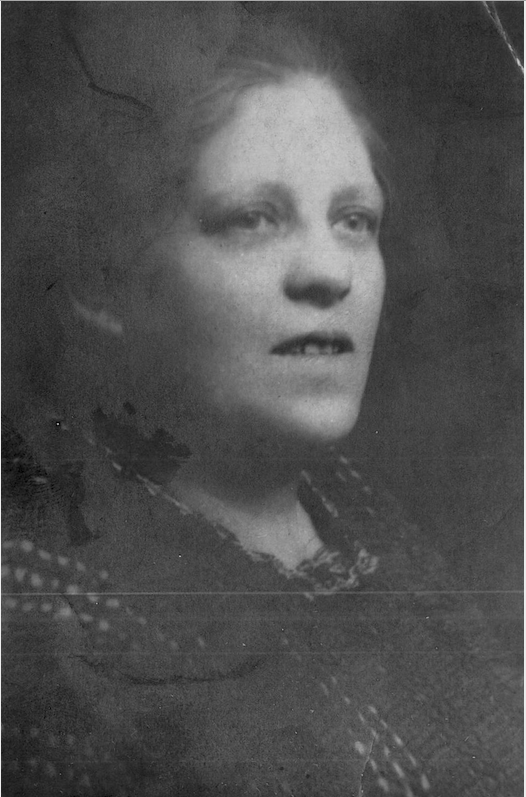
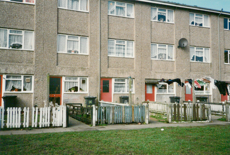
Mrs Sarah Calderbank, the Terraced House, Mount Pleasant Square, c 1910
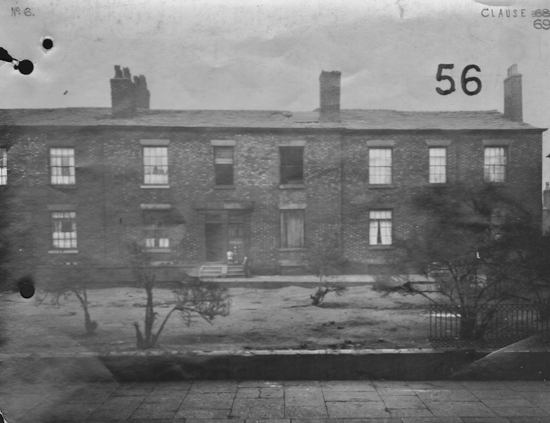
Mrs Sarah Calderbank lived at no. 10 Mount Pleasant Square. Her granddaughter Maggie was told: “It was a big old house and there were 13 children at one time or another.” Mount Pleasant was in the densely populated Trinity Ward was the first ward in Salford marked for ‘Slum Clearance’ after the Second World War.
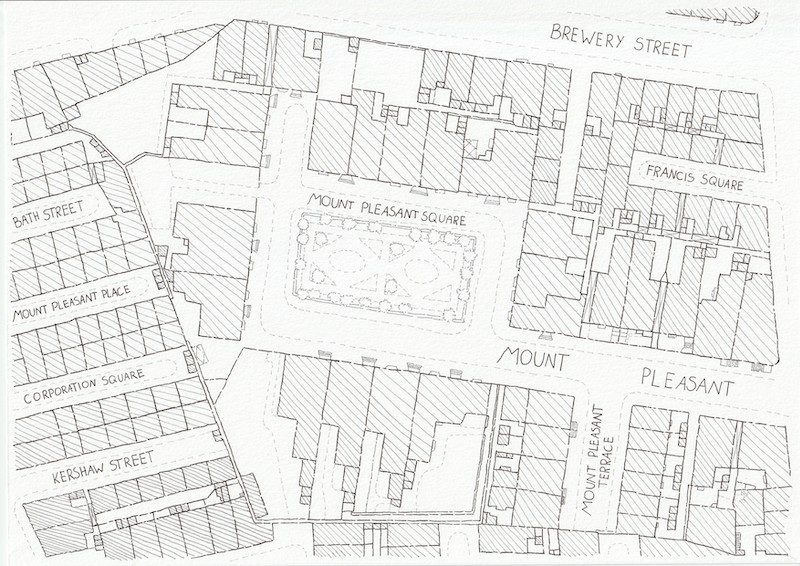
The photograph shows no 13 Mount Pleasant Street and neighbouring houses. While it is not certain that the photo shows Sarah house, it would have been comparable because most houses in and around Mount Pleasant Square appear to have been of a similar design. The map demonstrates this; the houses around Mount Pleasant Square and Street were much larger than the terraced houses on Corporation Square and Kershaw Street – visible on the left-hand side of the map.
Portrait Photograph: Provided by Maggie Smith.
Photograph of Terrace: Digital Salford, JOW00204.
Map: National Library of Scotland. OS Map, Lancashire CIV.6.17 1888.
Unknown Child, Vardo Wagon, c1930

The portrait shows a young child playing on a caravan site near Bold Street, Pendlebury. It is part of a set of photos documenting a traveller community in the 1930s. It can be assumed that the portrait is of a child living in one of the wagons. The hand drawing shows an interpretive section of a “Vardo” wagon alongside a “bender tent” that would have been used by the parents and the oldest children as an additional sleeping area. It illustrates the minimal amount of space and living conditions in these wagons.
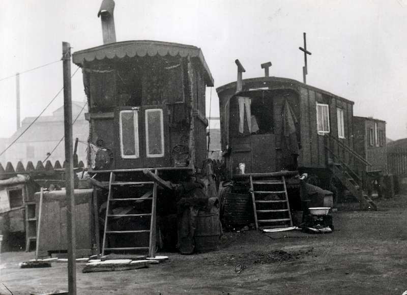
The small photograph shows a traditional “Vardo”-style wagon near Lottie Street, Pendlebury. At that time, these wagons were parked on the sides of roads and likely had no access to infrastructure (gas, water, electricity, toilets, etc.). In 1968 the Caravan Sites Act was passed, and travellers were provided with council-designated sites in which to park.
Portrait photograph: Digital Salford, PH00916.
Vardo Wagon photograph: Digital Salford, PH00926.
Hand drawing: illustrated is a section through a typical Vardo wagon, using photographs from Digital Salford and illustrations in: Ward-Jackson, C. H. & Harvey, D. E. (1972). English Gypsy Caravan: Its Origins, Builders, Technology and Conservation. David & Charles.
Mr Arthur Morton, Missions to Seamen, c1950
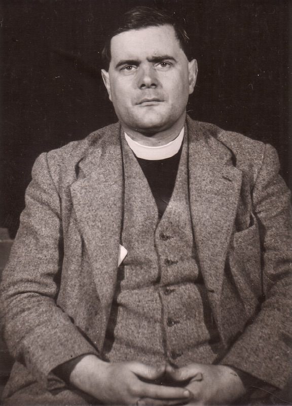
Reverend Arthur Morton served as a chaplain at the Missions to Seamen [today Mission to Seafarers] in Salford. The Missions were founded in 1856 to co-ordinate local Church of England missionary efforts in ports across the country. Branches built in ports were also known under the name “The Flying Angel.” The Missions aimed to serve the physical and spiritual needs of seafarers by providing accommodation, food, and entertainment. This can be seen in the drawing of the ground floor plan that includes two separate dining and billiard rooms for seamen and officers.
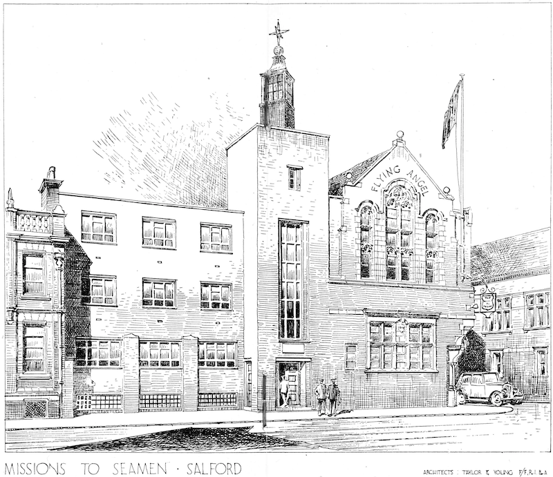
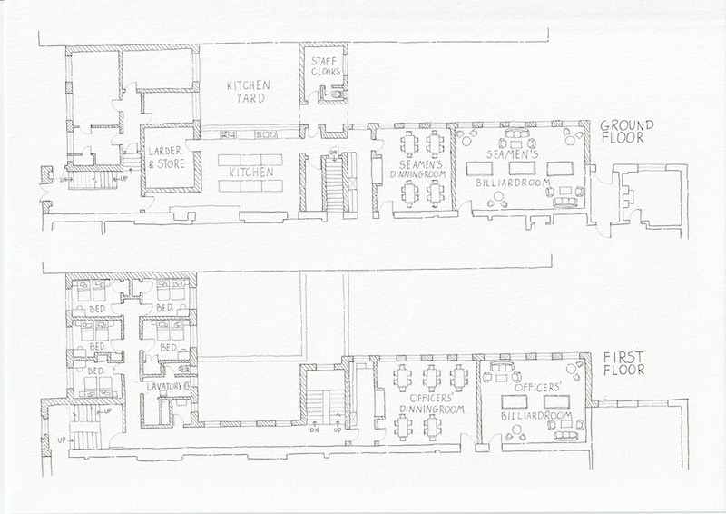
The branch in Salford was built in 1901 on Trafford Road and designed by Taylor & Young. The façade has modern as well as classical features and makes the building appear large. The plan, on the other hand, reveals that the Missions was a modest building with only a relatively small number of spaces.
Portrait photograph: Digital Salford, AT02372.
Hand drawing: the floor plan depicts the ground and first floor of the Missions and is based on the original proposal drawings published in the brochure: In Gratitude to the Seamen who Sailed from the Port of Manchester, 1939-1945 (1945), Salford City Archives, Ref: U55/AZ2
Mr and Mrs Green, Terraced House, Liverpool Street, 1946
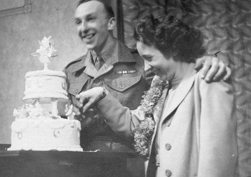
Mary Ellicock and Donald Green are cutting the cake on their wedding day on the 9th of January 1946. They were married at St Paul’s church in Salford and the photo was probably taken at Mary’s parent’s home at 244 Langworthy Road. The newlywed couple lived there about three years because of the housing shortage after the Second World War.
They rented their own first house at 94 Liverpool Street. A similar terraced house can be seen in the drawing. It followed a layout that could often be found in Salford as it had a parlour, living room, kitchen, and a toilet in the backyard. It also had a cellar which was a bit unusual. Upstairs were three bedrooms and a toilet. The upstairs toilet was unusual too, and Susan, Mary’s and Donald’s daughter, thinks that it was added by the landlord before the family moved it. There was no bathroom and baths were taken – as in most houses in Salford – downstairs in a tin bathtub.
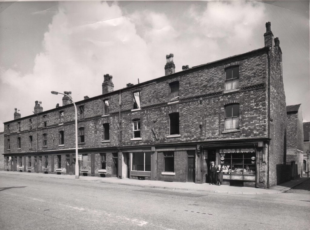
The photograph shows the neighbourhood where Mary and Donald lived – no.’s 124-142 Liverpool Street but it was taken when most of the houses were already abandoned and only the corner shop remained occupied.
Portrait photograph: provided by Susan Hughes.
Photograph of house: Digital Salford PF00167.
Hand Drawing: the section depicts a traditional two-story 1950s terrace, referenced from floor plan drawings of a terraced house on Huxley Estate in 1940s London, drawn by John Cole and compared against current house listings on Liverpool Street, Salford. See: Cryer, P. (n.a.) Victorian House Floor Plans. 1900s, https://www.1900s.org.uk/index.htm
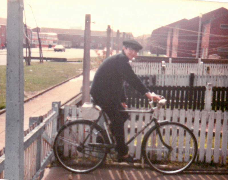
Christine, the Townhouse, c1970
Christine sits on a bike in the garden of her townhouse that is located at Denbigh Place, just off Cross Lane. Christine and her family used to live on Cromwell Road in Broughton, Salford in a terraced house and moved to the brand-new house in 1972. The small photograph shows its façade. It was a big and modern three-storey house with a pebble dash rendering and back garden.
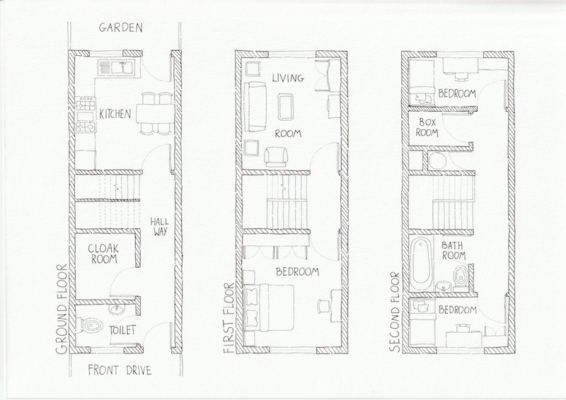
The floor plan shows the hallway, a downstairs toilet, cloakroom, kitchen, and a door to the garden. The first-floor landing led to a back living room and a bedroom at the front, and at the top of the house were two additional bedrooms and the bathroom.
Portrait photograph: provided by Julie Kay.
Photograph of townhouse: Provided by Julie Kay.
Hand drawing: the floor plans depict the ground floor, first floor and second floor of the 3-storey townhouse, interpreted from the description provided by Julie Kay.
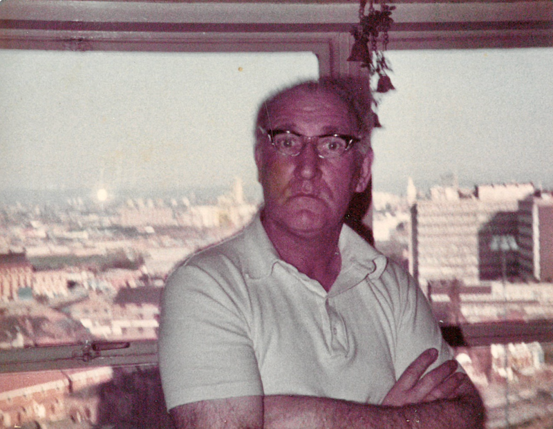
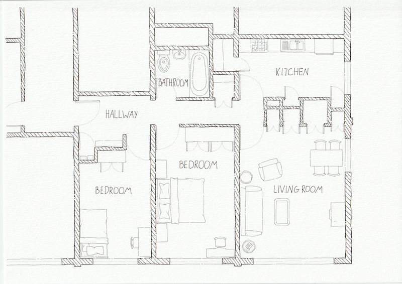
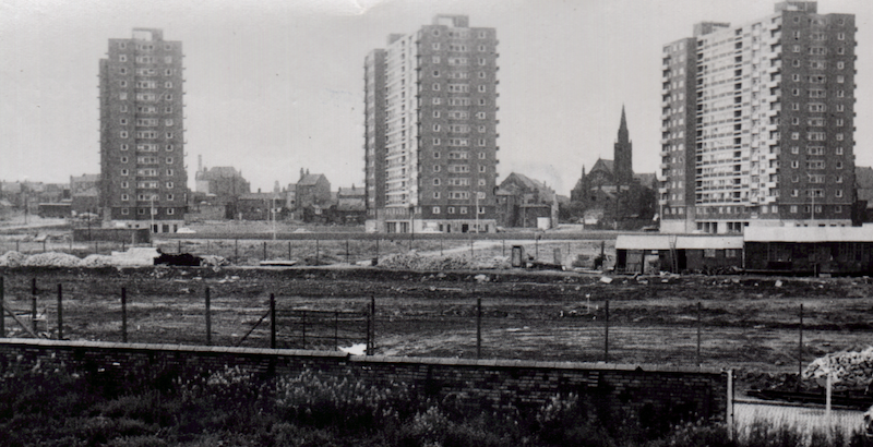
Mr John Davies, the Tower Block, c1970
Mr Davies – looking a little surprised – is standing in front of a window in his high-rise flat on the 12th floor of John Lester Court. He and his family had lived at Marple Street between Percy Street and Bury Street in the 1960s in the heart of the Hanky Park redevelopment area. This community had been very tightly knit and during the redevelopment of the area many decided to stay together and move with their neighbours into the newly built John Lester Court tower block. The photo was a snapshot taken by his daughter June and shows the wide view and large windows of these flats.
Portrait photograph: provided by June Pope.
Photo of John Lester Court, Eddie Colman Court, and Walter Greenwood Court from St Paul’s Paddington, Digital Salford, KB00038.
Hand drawing: the floor plan shows the high rise flat with a long hallway leading into the living room, kitchen, two bedrooms, and a bathroom. See Salford: Matthew, R H & Johnson-Marshall, P (1963), Ellor Street Redevelopment Area, Bella Vista Duddingston, Edinbrugh.
We would like to know more about these people and the types of houses displayed in this post. It is difficult to find details on working class people of the past and their houses. Please contact us: themodernbackdrop@salford.ac.uk